Reality Capture

Expertise

Our in-house Reality Capture team provides precise, data-driven insights to support your project at every stage. Whether integrated into our construction services or hired independently, we utilize 3D laser scanning, drone imagery, and ground-penetrating radar to capture accurate site conditions.

laser scan representation of a project

Inaccurate Drawings? Laser Scanning Can Help.

Whether you need to measure floor deviations, tolerances, or any other project component, we provide the tools to digitize existing conditions into 3D models and capture data with precision. Our Reality Capture team can proactively visualize your project with millimeter-accuracy to drive efficiency in planning. 


A drone flies in the sky

Your Eye in The Sky: Aerial Imagery

Your Eye in The Sky: Aerial Imagery

Our drones provide a safe, efficient way to capture high resolution project photography and videography, enabling dynamic site surveys and progress monitoring. Aerial imagery can be used for preconstruction planning, vertical inspections and more—providing real-time visuals of site coordination and reliable reference points throughout construction.

Drawing on concrete

Discover More With GPR

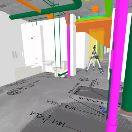
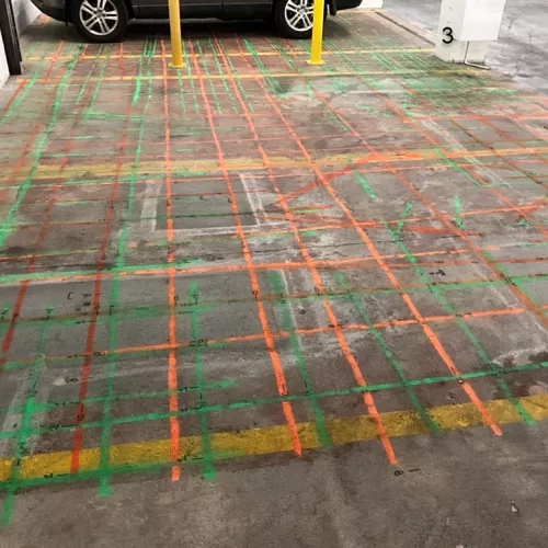
See what lies beneath with ground penetrating radar (GPR). Our Reality Capture team utilizes the cutting-edge Hilti PS1000 to locate embedded elements within concrete, including rebar and conduits, and analyze the safety and feasibility of core drilling in that area. GPR's underground mapping delivers precise data, eliminating guesswork and preventing costly damages and delays. We also capture a 3D scan of the targeted slab area and seamlessly integrate it within digital models for comprehensive reporting. 

When you engage our Reality Capture Team for GPR services, we exceed the standard. For optimal readings, concrete must be at least 90 days old, and our effective scan depth reaches up to 12 inches. For thicker concrete, we meticulously scan from both sides, ensuring thorough and precise results.