Flight Path to the Future: Drones in Construction
Drones have evolved into more than just flying cameras, fun new toys for enthusiasts and choreographed light shows. As their hardware advances, they’ve become industry tools that can provide many benefits to a project team’s workflow. Unmanned aerial vehicles (UAVs) can provide accurate, real-time data as they map out an entire construction site, making work more precise. They can also provide lesser-known benefits, including added safety. DAVIS has implemented drone tech on projects of our own--here's what we've learned.
Maps and models
Creating models based on existing site conditions can be time-consuming, difficult and rife with inaccuracy. Drones can help alleviate those issues with the sheer amount of data they can quickly compile. UAVs can be equipped with software programs and sent on a flight path to take hundreds upon hundreds of images, stitch them together and create scalable 2D maps and 3D models. The process is straightforward — field teams locate targets on the ground, plug the corresponding coordinates into the software, then the drone recognizes those points within the image capturing process and the software scales the imagery appropriately.
Using these maps and models, anyone involved in the design-build process can visualize and understand projects on a higher level using real-time, accurate data. For instance, one could take elevation measurements at any point on the site as the work progresses. An owner looking to renovate their space in the future can keep record of each part of the original construction, including elements inside the concrete slab, or a superintendent can figure out where to put their trailer or where to install future work. Instead of relying on an outdated 2D aerial photo, field staff can use an up-to-date 3D model of the site and surrounding area for use in their logistics plans or overlay a 2D map of a proposed building onto a site’s current conditions.
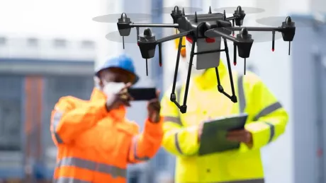
Safety
In addition to creating maps and models, UAVs can also provide invaluable safety benefits. They can be a great tool to use for visual inspection of difficult-to-reach locations — façade details at great heights or other work around dangerous conditions such as power lines can be captured without putting personnel at risk. Project sites can be crowded — trucks come and go, cranes get set up and taken down — and UAVs can fly above any site activities and capture the photographs project teams need.
Challenges
When considering whether drones are the right fit for a project, there are some things our team keeps in mind. The most important factor is figuring out where you can legally fly drones according to the Federal Aviation Administration (FAA) — the Washington, D.C. region has the most restrictive airspace in the country, and proximity to a large airport may make a drone unusable on your site.
Proper planning is crucial when utilizing a UAV. Some variables can impact the effectiveness of the image capturing process, including the sun’s rays. Shadows created from other structures, terrain or any elevated feature can impact quality. High winds and inclement weather can make it difficult or impossible to fly, too.
These benefits and challenges are just a few considerations that are important to keep in mind when deciding if a UAV is right for a project. For a comprehensive approach, a conversation with a virtual construction expert is vital. To learn more about how DAVIS Construction’s virtual construction process works, visit our VC page!
Recommended Reads

Q3+Q4 2025 | Market Report


Q1+Q2 2025 | Market Report


State of the Market Report
